
Science Snapshots: Everything that is Wrong and Wonderful about Twister (Part 1 of Several)
"I gotta go Julia, we got cows!"
If you know me, you know I'm a meteorologist ("sure you are" - everyone) and that means you all now have to endure my love for Twister, specifically my list of things that are hilariously wrong or wonderful about this movie. If you don't want spoilers for a film that came out in 1996, you should probably turn back now.
Shortly before Independence Day was released, those of us alive in the 90s were blessed with every child nerd's fantasy movie: Bill Paxton and Helen Hunt heroically throwing their vehicle into a massive cloud of CGI dust and saving mankind as we know it, by learning everything about tornadoes using a knockoff of an instrument designed in 1979. Along the way, they had to deal with the evil corporate-sponsored chasers trying to beat them to the punch. Who knew a prediction from Twister would actually come true one day? Looking at you, Reed Timmer, or should I say JONAS MILLER!
There's just so much to cover, so I'll be sprinkling these posts periodically in between actual science discussions. Today's tasty Twister tidbit: Cameos in the opening scene!
The film opens during June 1969, when benign but dark CGI clouds gather across Oklahoma. You know it's Oklahoma because they showed an oil pumpjack and you know it's bad weather because those benign clouds are DARK.
A tornado warning is playing on the TV, and this is one of the best parts of the film to me. The radar
imagery being shown on the set is from a WSR-57, which stands for Weather Surveillance Radar 1957.
NOTHING is better than radar. This was the first modern weather radar and the National Weather Service operated a network of these radars across the U.S. It's possible it's actually the television station's own radar and not from the NWS, but the general type of radar is the same. Unlike today's radars, the WSR-57 did not show wind speed and direction (Doppler radar), just an echo of the storms. This made the forecasters' jobs much more difficult than they are today, where they can actually see the rotation of a tornado via radar (called a Tornado Vortex Signature). They had very little data to go on outside of those little white blobs and emergency personnel or the public calling in information on the storms they saw. I don't know about 1957, but in 2023 usually the public calls in random clouds vaguely shaped almost, but not quite, entirely unlike tornadoes, or just to complain about their TV shows getting interrupted by a warning.
imagery being shown on the set is from a WSR-57, which stands for Weather Surveillance Radar 1957.
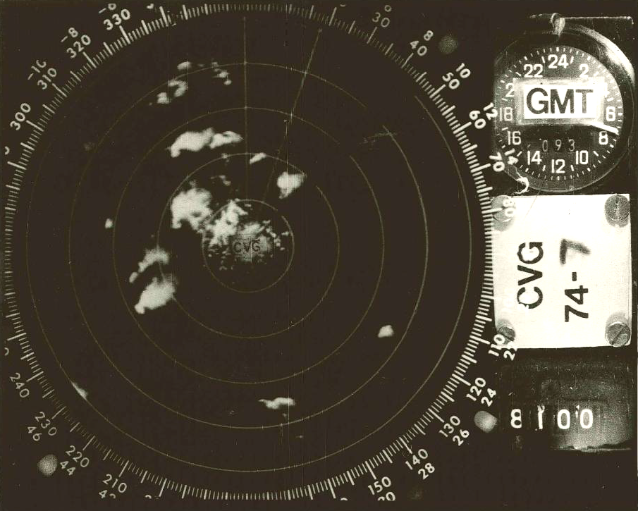 |
| Example of a WSR-57 image from the 1974 Super Outbreak. |
NOTHING is better than radar. This was the first modern weather radar and the National Weather Service operated a network of these radars across the U.S. It's possible it's actually the television station's own radar and not from the NWS, but the general type of radar is the same. Unlike today's radars, the WSR-57 did not show wind speed and direction (Doppler radar), just an echo of the storms. This made the forecasters' jobs much more difficult than they are today, where they can actually see the rotation of a tornado via radar (called a Tornado Vortex Signature). They had very little data to go on outside of those little white blobs and emergency personnel or the public calling in information on the storms they saw. I don't know about 1957, but in 2023 usually the public calls in random clouds vaguely shaped almost, but not quite, entirely unlike tornadoes, or just to complain about their TV shows getting interrupted by a warning.
 |
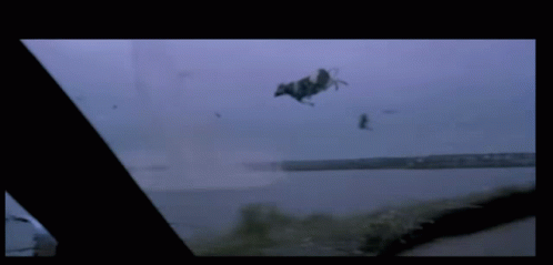
| Screenshot of the tornado warning broadcast in Twister |
Despite this, weather radar was a HUGE step forward in the history of modern weather forecasting, perhaps second only to the launching of the first weather satellite (TIROS 1) on April 1, 1960. Have you heard of the infamous hook echo? Well, the first time this was recorded on radar was on April 9, 1953, and this discovery helped launch the network of WSR-57s to enhance our nation's weather warning capabilities. Aside from geeking out over the old school radar, the other exciting part of this scene is it came from an archive of an actual KWTV broadcast (a news affiliate in Oklahoma City) and featured legendary broadcaster Gary England. He also had a legit degree in meteorology rather than just being a pretty face. It's not clear based on my research what the actual event was, but you can view a longer clip of the archived broadcast here. It was possibly the Union City event in 1973.
Next in this series: Bill Paxton comes face to face with his old storm chase crew with a new lady in tow!


Comments
Post a Comment