Science Snapshots: Everything that is Wrong and Wonderful about Twister (Part 3 of several)
Part 1 here
GOES 8 really plays no role in Twister except perhaps to show the advancement of technology since Jo Harding's entire life course was altered during that June 1969 tornado. After all, the theme of Twister is "we're going to use this technology-forward instrument pack to study the insides of tornadoes because scientists haven't gotten their shit together about that despite the fact our design is a knock off of one from 1979."
Part 2 here
It only took me two long ass articles to get through the opening scene, so you know you're in for a long ride! So if no one continues to read this series...that's cool. I'll rant to myself.
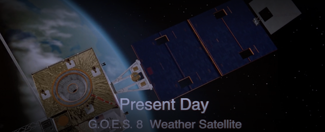
After the devastation of the F-5 tornado that we learned last time would never have been referred to as such in 1969, we jump forward to present day (1996). Showing the huge leap forward in weather observing technology, we encounter GOES 8 flying across the screen.
 |
| Screenshot of the satellite from Twister |
Note that I've never seen GOES referred to as G.O.E.S. Who does that? Jan de Bont, apparently.
GOES stands for Geostationary Operational Environmental Satellite. Except I learned in school it means Geostationary Orbiting Earth Satellite. The official NOAA page says the former though so I'm guessing either this is a Mandela Effect or they changed it randomly somewhere down the line. The first GOES was launched in 1975, and ever since then we've been continuously monitoring the Americas' weather via the GOES program and I can't state enough how weather satellites revolutionized forecasting. Here's the first image from GOES 1:
 |
| Via Wikipedia |
At any given time, we have two active GOES satellites, one focused on the eastern part of the US and the other focused on the western part, hence sometimes being called GOES East and GOES West. GOES 8 was the eastern flavor. Here's the first image returned from that satellite in 1994.
 |
| Via Wikipedia |
Perhaps you notice the 20 year technology upgrade in imagery between the two! GOES 8 provided a new image every 15 minutes if I remember correctly.
Weather satellites observe a number of bands. A band is simply the wavelength, or size, of light that the satellite can see. The visible band will observe at red, green, and blue color wavelengths to build a true color picture of the Earth. The infrared bands will look at heat signatures. This is helpful to see tall cloud tops (cold) vs low cloud tops (warm). A puffy looking cloud with very cold temperatures indicates a thunderstorm, and if the cloud top continues decreasing in temperature with time we know the storm is growing and can calculate an approximate height. The height of a storm is an indicator of its strength. There are a large number of other bands, but I will mention one more that is important: at approximately 6.9 μm, we can see water vapor in the atmosphere. All of this gives a forecaster information about what's happening now and how it's moving, as well as what is 1-2 days upstream from their location. As an example, in the image above I see a low pressure system somewhere around western Kansas, and likely Texas was getting some storms starting to form at the time and the southeastern US would see that system tomorrow.
The really cool and useful thing about GOES and other geostationary satellites is the fact that they can look at the same area of Earth the entire time they are operational. This is as opposed to polar orbiting satellites, which generally update imagery of a specific location once or twice a day (more often close to the poles). As you can imagine, the former is much more useful for operational meteorology. The trick is that these satellites are positioned 22,236 miles (35785 km) above the Earth's equator. This allows the satellite to orbit the Earth at the same rate as the Earth rotates, hence relative to the Earth the satellite appears stationary. This video from NOAA shows how that works.
GOES 8 was actually used for 10 years, retiring in 2004. Today, we have GOES 16 (2017) and GOES 18 (2023) operating in the east and west respectively. Advancements include 5 minute imagery updates and a total lightning imager. Total lightning just means all the lightning, as opposed to just cloud to ground strikes. These updates are part of the GOES-R generation of satellites (https://www.goes-r.gov/).
Other areas of the world are covered by other geostationary satellites. The two shining stars would be Meteosat covering Europe, Africa, and Western Asia (https://www.eumetsat.int/) and Himawari covering Eastern Asia, Australia, and the western Pacific islands.
So there you have it. An entire article on approximately 10 seconds of Twister footage.
Learn more about GOES here: https://www.noaasis.noaa.gov/GOES/goes_overview.html
View GOES, Meteosat, and Himawari observations here: https://www.goes.noaa.gov/


Comments
Post a Comment